Greetings from Cape Town
The last installment on our Bulungula Adventure (www.bulungula.com/) ended as we turned off the main road from East London. Allow me to explain “main road” in South Africa. Our limited access highways and toll roads find their equivalents as the “main roads” close to the major urban areas such as Johannesburg, Durban and Cape Town. The further from a big city that you drive on a main road, the more likely that it will become a two-lane road – always paved but not always in the best condition nor protected from wandering domestic animals. Such was the case with the N2 within 10km after leaving East London. When you leave the main road your secondary roads can be tarred roads (blacktop), gravel roads or dirt roads, all in various states of drivability.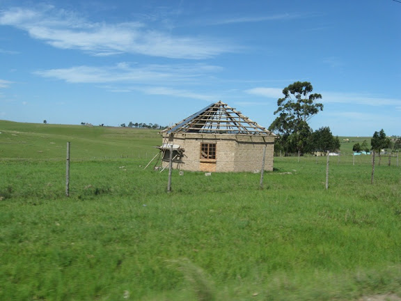
Our map told us to proceed 37km down the tarred road before turning – so we did. Betsy took all the pictures and I focused entirely on driving – avoiding livestock, potholes and other vehicles. The picture shows a somewhat typical home in the area. Somewhat because most are not hexagonal in shape as you will see. 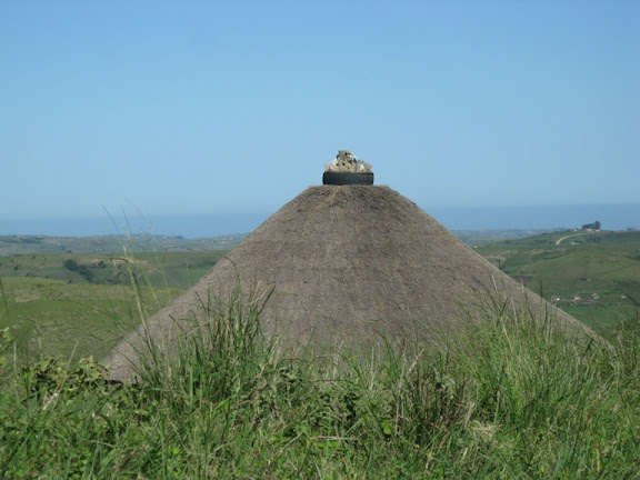
The roof is of typical construction; poles supporting a thatch. Notice the use of an automobile tire keeping the top together. The tire is apparently filled with soil as we often saw plants growing in the mini-garden. We also observed these rooftop tires with seashells as decorations.
The more typical shapes are either round (a Rondavel) or rectangular. Dimensions tend to be dictated by the lengths of available poles. This will also be true of the shape of the school being planned for Bulungula. Acquiring and transporting 2x12’s would be incredibly expensive.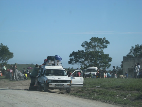
We reached the first turnoff point, 37km from the main road. Our directions told us to turn right, onto an unpaved road and drive for 20km. The picture shows the turn, obviously a local trading area. We took the turn and within 1km wished that we were driving a 4wd vehicle instead of a small Hyundai. The pictures taken during this phase of the trip are scarce because we were both holding on for dear life.
This 20km section took us about an hour to navigate. We were not looking forward to the return trip. All the locals were friendly, waving, smiling, and, in the case of young children, holding out cupped hands. They’ve learned to beg although the land seemed rich and none looked poorly fed or dressed. Seems to be a tourist-related thing. What a shame.
The next phase of our trek came with unclear instructions: something about crossing a creek, going on approximately 3.4km, not going as far as the building with a blue roof, etc. It was actually much simpler than that. We turned at the sign which said “Bulungula Parking”, turned into the first building which turned out to be the local shabeen (tavern), and were redirected to a building a few hundred meters down the road.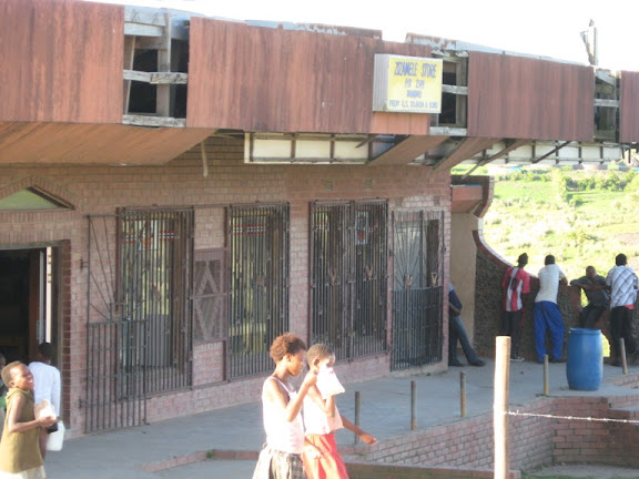
This was where we were to abandon our rental car for the balance of our stay. A vehicle from the lodge would be arriving to pick us up and ferry us the rest of the way, over the rough road. We have no pictures from that ride either, for the same reason as before. It is now clear to us why they call this the Wild Coast. 
This picture shows the Bulungula Lodge from a distance. It’s an idyllic setting, at the mouth of a river, lots of beach, sand dunes, in the middle of a village. The village, by the way, is not a concentration of homes, but more like a farming community. The homes are spread out across a 5km square area and most transportation is by foot.
The lodge operates as a carbon-neutral system. That may not be the exact terminology, but that is the effect on the environment. They use solar and wind power for electricity, have composting toilets, use gray water from showers and sinks, collect rainwater for drinking, and plant trees to offset the petrol consumed by their shuttles. Of course the local population has none of the above; no electricity, no toilets, and only a few use the rainwater for drinking and washing their clothes. Most use the rivers or estuaries for water.
I will cover more of the details in a later journal issue. We picked up quite a bit of useful information and plan to share appropriate tidbits with our partners in Ghana.
Anyway, we had arrived, safely, if a bit jostled, about 7:00pm and were warmly welcomed by all. After a filling dinner and a 750ml cold beer, we headed for bed, ready for new experiences and new friends the next day.
(to be continued)
Floyd
Tuesday, December 18, 2007
Bulungula II
![]()
Subscribe to:
Post Comments (Atom)
No comments:
Post a Comment